SphereVision Project
Visualise sites, buildings and assets remotely. Easily view media on maps, plans and diagrams.
Choose to keep your data offline or share online.
Supported Cameras
-
Ricoh Theta
Insta 360 Titan / Pro
Insta 360 One / X / R /1-inch
GoPro Fusion / Max
SphereVision 360 Systems
NC Tech iStar
-
GoPro Fusion / Max
SphereVision Recording Systems
Insta 360 Pro / Titan
-
DJI drones with subtitles embedded / in SRT file
GoPro Hero with GPS
-
Any camera with positions in EXIF metadata - this includes most mobile phones.
SphereVision Project also supports jpeg and png images from any camera and video in .mp4 for manual positioning where GPS is not available.

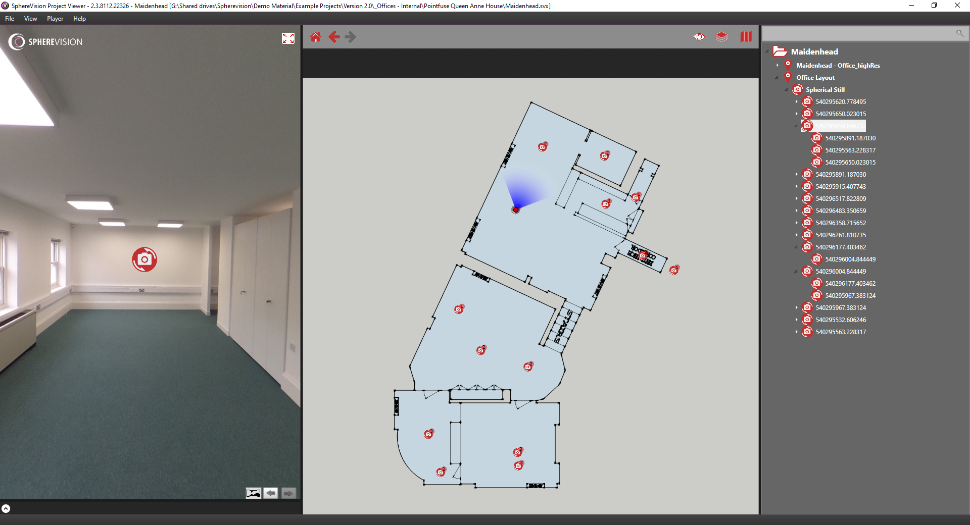
Visualise 360 Degree media on maps, blueprints or plans. Import 360º images from every 360º camera, alongside traditional media. The intuitive user interface guides project creators to seamlessly create interactive routes. The iSTAR measurement module delivers a rapid dimensioning solution directly within spherical imagery.
Additional site specific media can be linked using interactive hotspots. A wide range of media are accepted:
Supported Media
360/180 Video
360/180 Stills
Images - JPG or PNG
PDF Documents
Web Links
Audio Files (mp3)